A date has finally been set for the official closure of the North Surrey Recreation Centre to make way for the site’s long anticipated redevelopment. In a notice posted on the recreation centre website, the facility is planned to close in 2 phases beginning with a decommissioning of the ice rinks in early September, and finally a closure of the remaining portions of the building on December 22. Ice rink programming will move to the new North Surrey Sport & Ice Complex, set to open on September 3 near Scott Road Station. Following that in January, Aquatics programs will move to Guildford Recreation Centre, fitness and multi-purpose activities to North Surrey Sport & Ice Complex, and preschool programs to Chuck Bailey Recreation Centre.
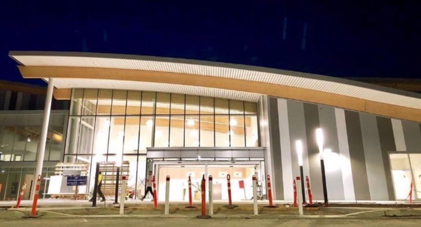 New North Surrey Sport & Ice Complex
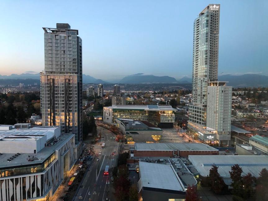
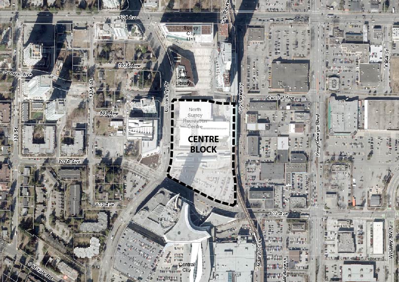
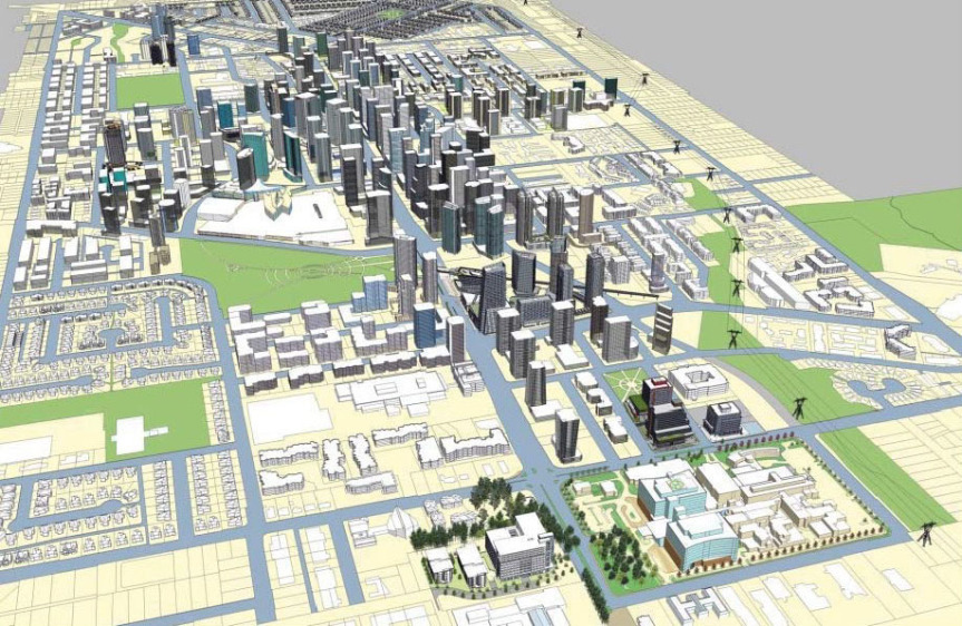
While no timeline has been given for the site’s redevelopment following decommissioning, behind-the-scenes planning work has been underway for years, dating back to 2012. Since then, the City has been working with Simon Fraser University, TransLink, and various architects, planners, and consultants, on a master plan for what is known as the ‘Centre Block’ bounded by Central Avenue to the north, 102 Avenue to the south, University Drive to the west, and City Parkway to the east. Well-positioned adjacent to Surrey Central SkyTrain Station, the site forms a key link between Surrey City Hall / Civic Plaza to the north, and the Central City Complex and beyond to the south.
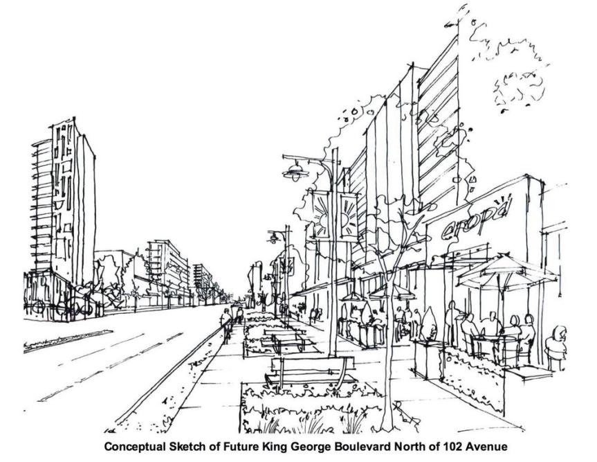
Back in 2013, Via Architecture prepared a ‘vision’ for what redevelopment could look like in the future. The concept envisioned a numerous mixed-use buildings for the site integrated with a transit-oriented plaza linking City Hall to Central City. The buildings would contain office, university, and retail space. The plan also envisioned:
- A new bus layover facility to be located on 133A St behind the new SFU Engineering building.
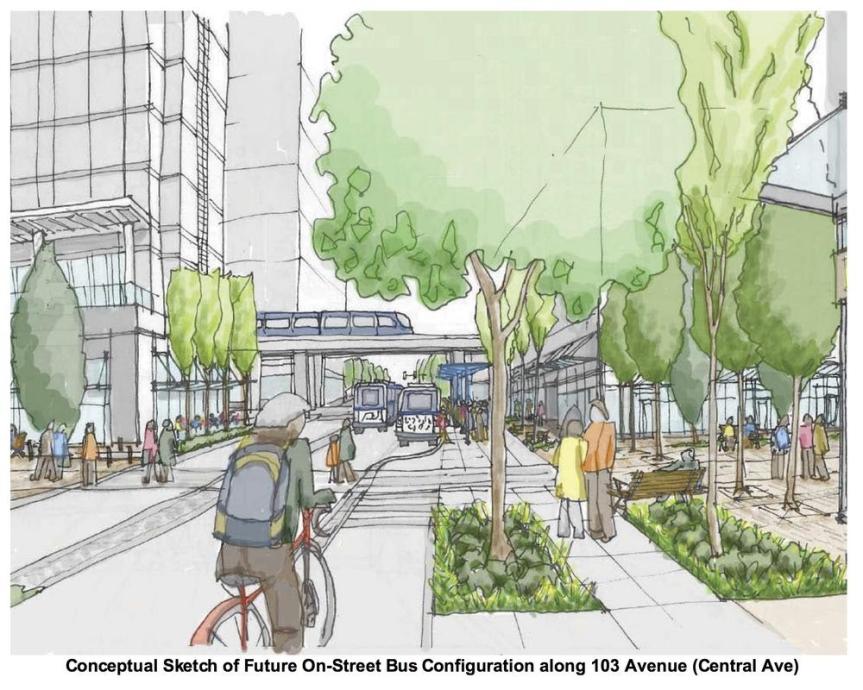
- A removal and re-configuring of the Surrey Central Bus Exchange – replacing the loop with a new street-oriented exchange along a realigned 102A Avenue and Central Avenue. The 2 streets would be integrated with a new Transit Plaza, designed to accommodate high pedestrian and bus passenger volumes.
 Centre Block location between Civic Plaza and Central City
 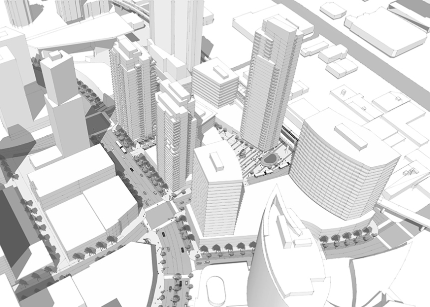 Early vision for the Centre Block prepared by Via Architecture in 2013
Since the early Via Architecture vision, a more recent planning process has been underway following a Surrey City Development Corp (SCDC) RFP was filled seeking a new firm to undertake detailed master planning work for the Centre Block site. While no plans have been publicly released yet, what is expected is a major overhaul of Surrey Central Station linked with a new transit-oriented plaza connecting Civic Plaza to Central City, and integrated with over 2 million square feet of new office, university, and retail space. With such a large scale, the plan is expected to be completed in phases, with various puzzle pieces and phasing needing to take place before other phases can begin. The first of those pieces is the decommissioning and demolition of the North Surrey Recreation Centre. The second will be the construction of the new bus layover facility on 133 Street, allowing for removal of the current Bus Loop, and re-alignment of 102A Avenue through it.
With the North Surrey Rec Centre decommissioning now in sight, the pieces are finally coming together to make the Centre Block redevelopment a reality. While the project is likely to take at least a decade to build-out, we could see the start of application activity related to it in the coming year.
For more on the North Surrey Recreation Centre closing:
https://www.surrey.ca/bylawsandcouncillibrary/CR_2019-R133.pdf
Public consultation is set to get underway this month for the proposed Surrey Langley SkyTrain (SLS) extension, as well as the future of rapid transit along 104 Avenue & King George Blvd.
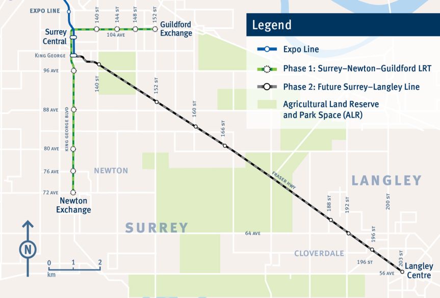
In 2014, the regional Mayors Council identified Fraser Highway, King George Boulevard, and 104 Avenue as priority corridors for rapid transit South of the Fraser in the 10-Year Vision. Following a study looking at combinations of SkyTrain, LRT, and Bus Rapid Transit for the corridors, the Mayors Council decided on 27-km of urban-style LRT on dedicated track (separate from traffic) on each of the corridors to be built over 2 phases:
- Phase 1: Surrey-Newton-Guildford Line on 104 Avenue & King George Boulevard
- Phase 2: Surrey-Langley Line on Fraser Highway
With funding in place to cover the entire first phase, and construction set to begin this year – a last minute request was made in 2018 by Surrey’s new Council to the regional Mayors’ Council to suspend the Phase 1 Surrey-Newton-Guildford LRT line and re-direct funding to the Phase 2 Surrey-Langley line instead, while switching the technology of the Phase 2 line to SkyTrain. The Mayors’ Council voted to move forward with this request, and directed TransLink to begin planning work for SkyTrain on Fraser Highway while at the same time re-visit rapid transit plans for 104 Avenue and King George Boulevard corridors.
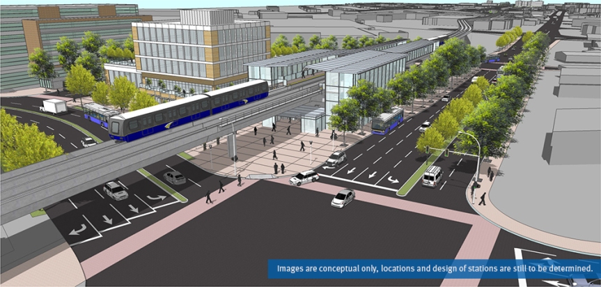
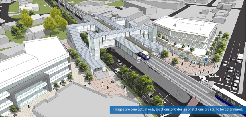
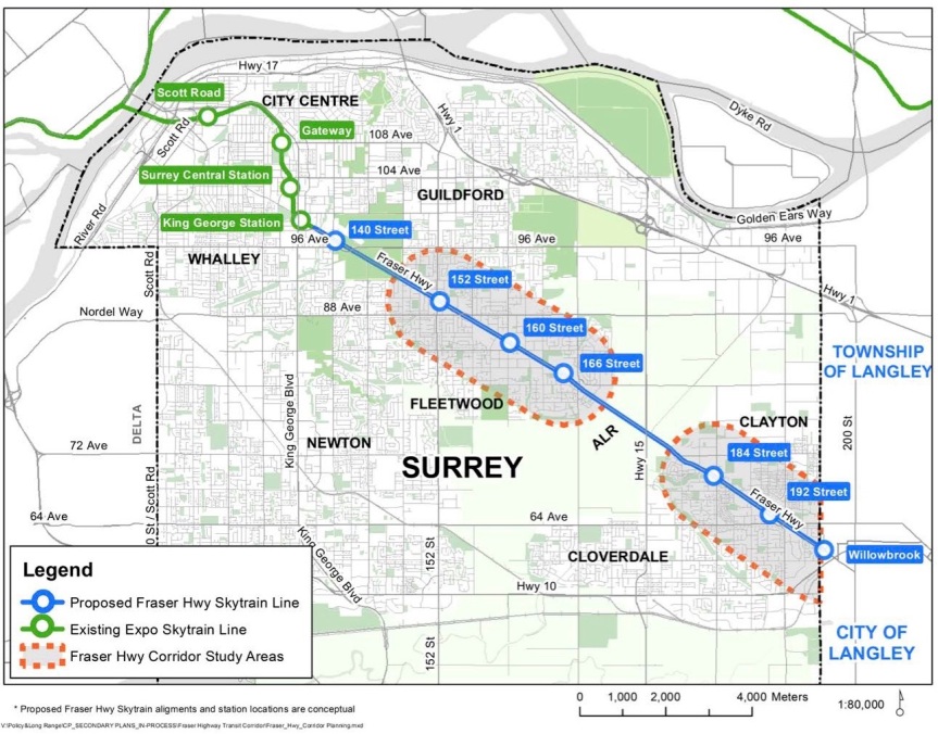 Proposed Surrey Langley SkyTrain route and conceptual stations
The switch of priorities to the Phase 2 Fraser Highway line and changing its technology to SkyTrain has had implications both in budget and timeline. The funding that was allocated for the full Phase 1 Surrey-Newton-Guildford LRT line has been identified as inadequate to fund the entire Fraser Highway SkyTrain extension to Langley. Pending a future round of funding (timeline unclear), the line may have to be phased, with the current funding getting the line potentially only as far as Fleetwood. Start of construction and delivery of new rapid transit South of the Fraser is also now delayed by approximately 2 years as a result of the switch.
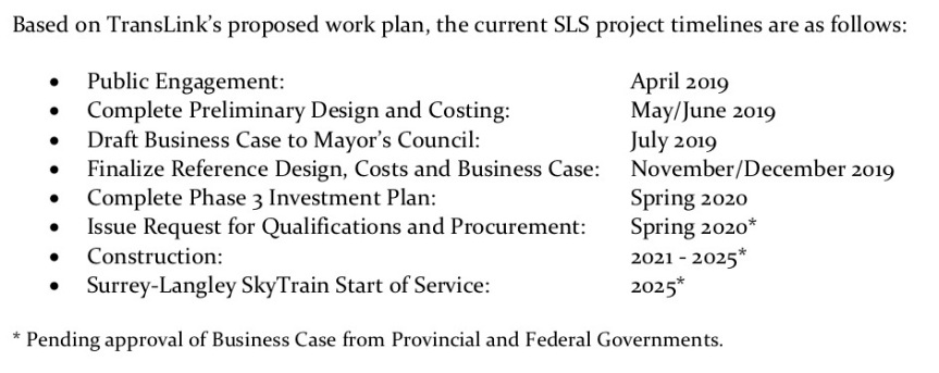
Despite the funding and timeline uncertainties, planning work is nonetheless well underway for the new SLS line, which will need to involve a significant re-evaluation of land-use plans along the Fraser Highway corridor to support SkyTrain, completion of a number of supportive studies, and extensive Public Consultation. In a project update report to Surrey Council this week – a preliminary timeline was given for this work by TransLink, with start of service targeted for 2025.
To run concurrently with the SLS planning and consultation work will be a planning process to ‘refresh’ the South Fraser Rapid Transit Strategy for delivering the Mayors’ Council fully envisioned 27km of Rapid Transit along each of the Fraser Hwy, King George Blvd, and 104 Ave corridors. This refresh will look to re-examine and engage the public on what rapid transit along the remaining corridors could look like, now that SkyTrain has been chosen as the technology for Fraser Hwy. The 2013 Rapid Transit Alternatives Study identified Bus Rapid Transit (BRT) for these corridors based on a scenario with SkyTrain on Fraser Hwy. With much LRT planning work having now been completed however, for the 104 Ave and King George Blvd corridors, it’s possible that LRT could still be an option for them rather than BRT, especially given Surrey’s long-term rapid transit vision for an extensive LRT network on major arterials across the City.
The first round of Public Consultation on the SLS line and South Fraser Rapid Transit refresh gets underway on April 11 in Langley, with open houses in Surrey on April 15, 16, and 17. TransLink has also recently launched an online survey where you can voice your feedback on the proposed SLS line. Open House times are set for the following dates and locations between 3-8pm:
- Thursday, April 11 – Langley City Hall
- Monday, April 15 – Surrey Sport & Leisure Complex (Fleetwood)
- Tuesday, April 16 – Surrey City Hall
- Wednesday, April 17 – Newton Seniors Centre
More info on the land-use planning review process for the Fraser Highway Corridor being undertaken by the City of Surrey can be found here: https://www.surrey.ca/bylawsandcouncillibrary/CR_2019-R059.pdf
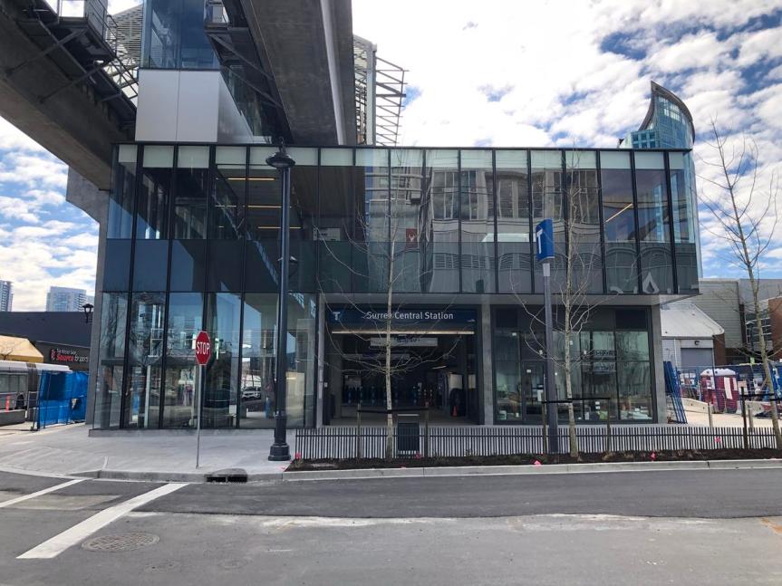
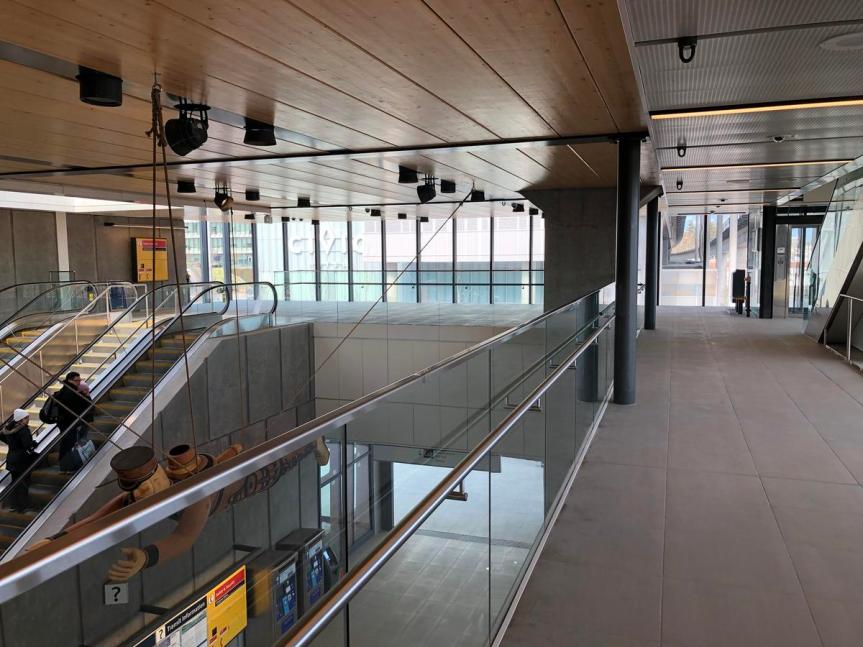
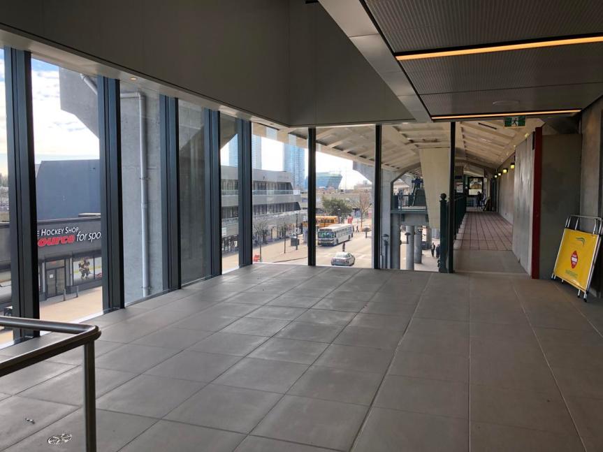
After nearly 2 years of construction, the Surrey Central Station north station house expansion officially opened to the public this weekend. Designed by OMB Architects, the new 2-storey station house is now the largest entrance at the station, fronting directly onto the corner of Central Avenue and City Parkway across from Civic Plaza.
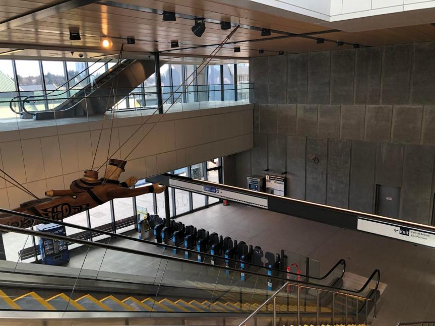
The new station house features a contemporary, open, and airy design consisting of glass, concrete, and wood materials, as well as a prominent new First Nations art installation suspended from the ceiling – ‘The Sea Captain’ by Marianne Nicolson. A new retail unit has also been added to the station next to the entrance fronting Central Avenue, but has yet to be occupied by a tenant.
 New entrance fronting Central Ave
 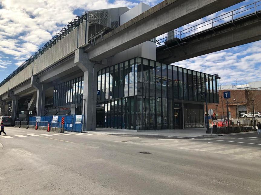 Corner of Central Ave & City Parkway
 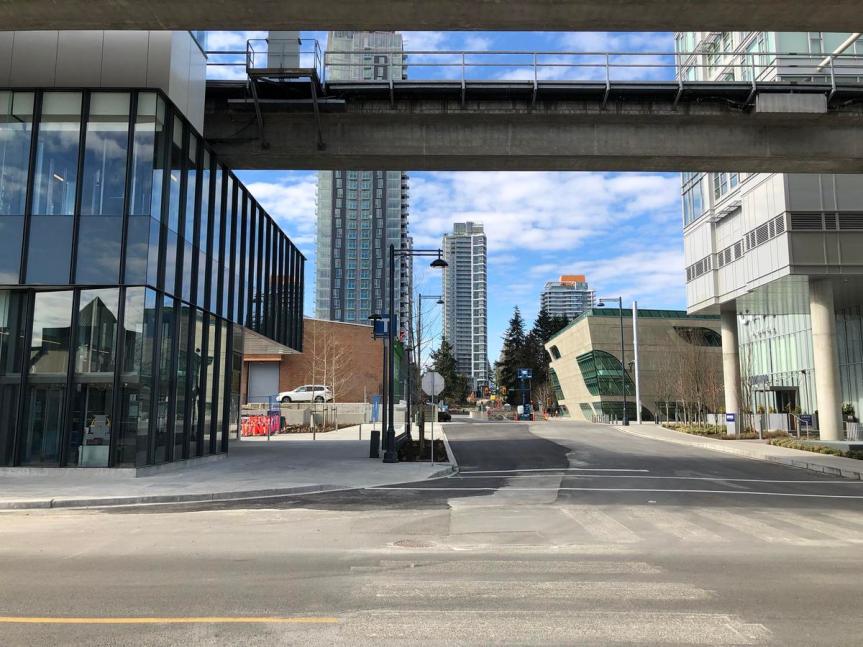 Looking west down Central Avenue
 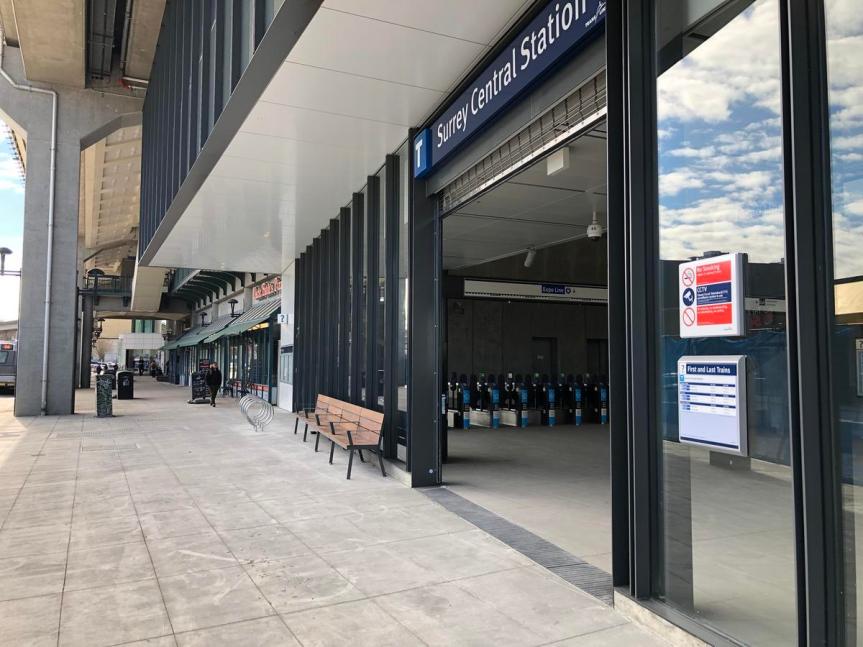 New entrance on City Parkway
 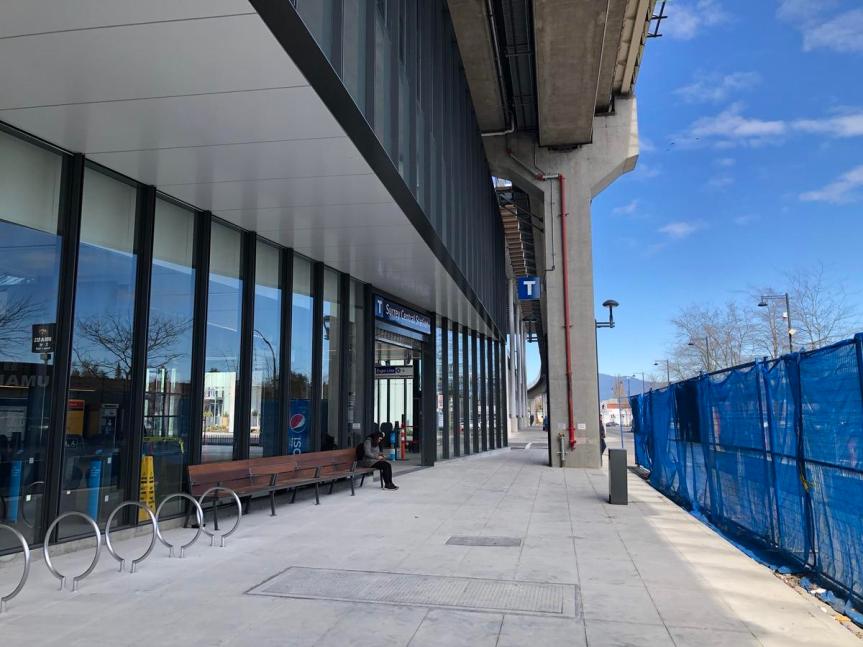 New entrance with bike racks and benches on City Parkway
 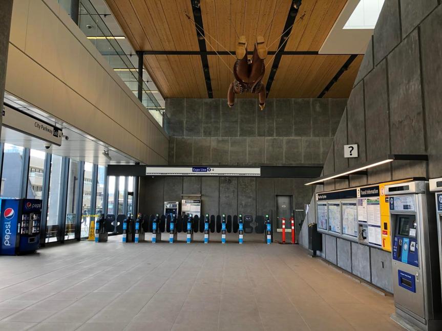 New ticket and fare gate concourse
 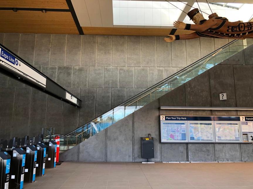 Fare gate concourse and art installation
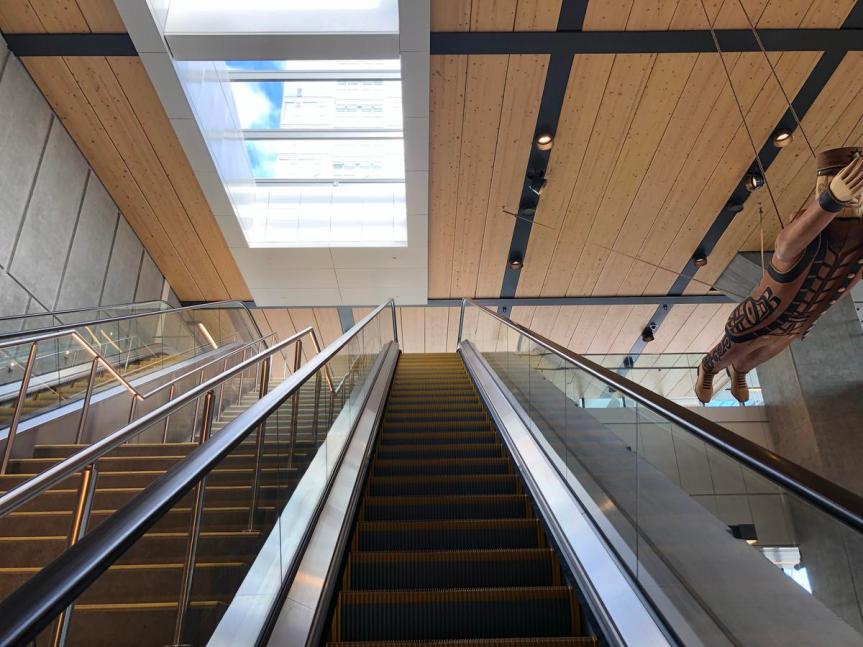 Escalator to second floor concourse
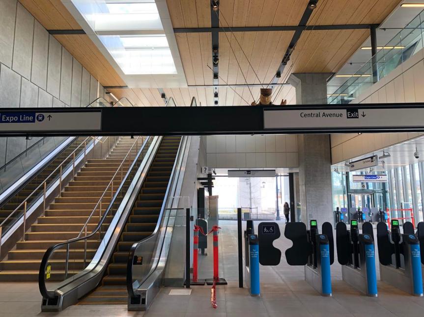
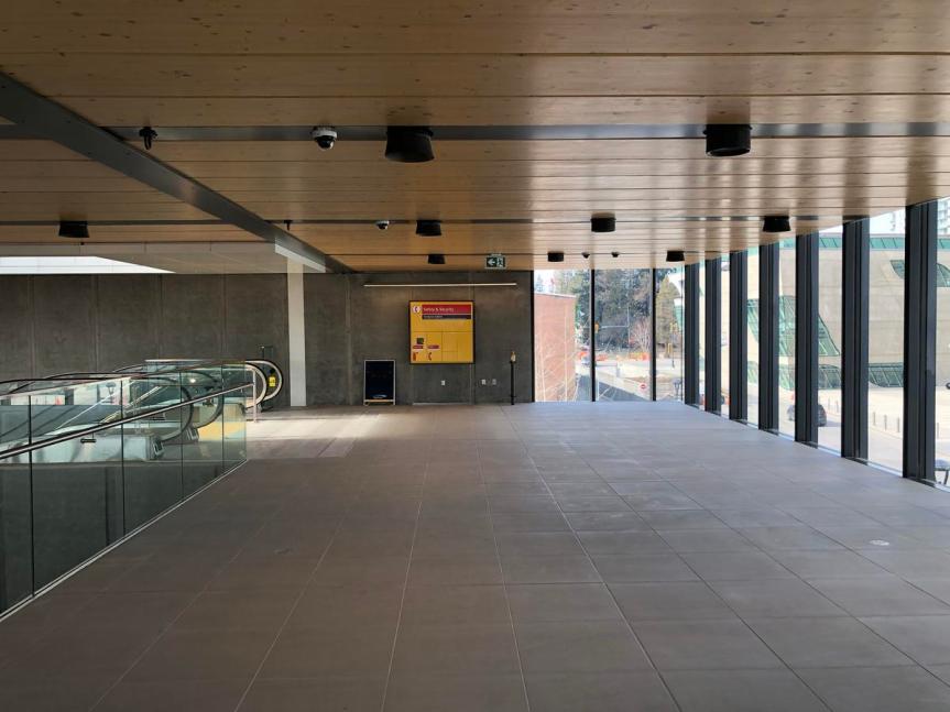 2nd floor concourse
 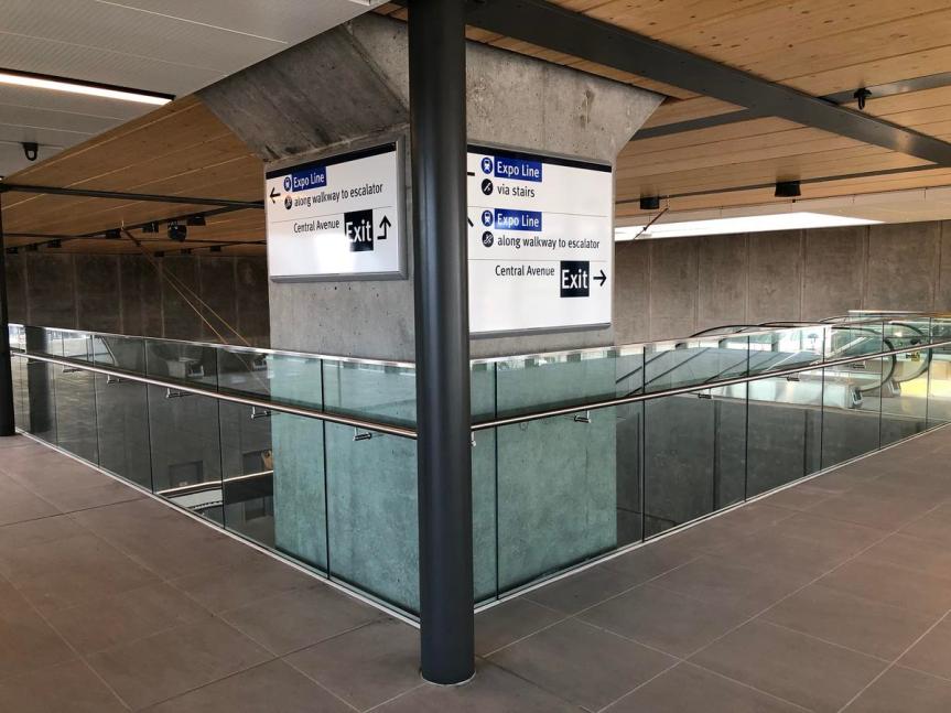 Wayfinding signage on second floor concourse
 Connection to south station entrance
  New platform level stairs, escalator and elevator
This latest upgrade to Surrey Central Station is just the beginning of an even larger expansion and re-configuration to come in the future. The lands immediately west of the station, where the current North Surrey Recreation Centre and Bus Loop sit – known as the ‘Centre Block’ are expected to be redeveloped in the coming decade. With that will come the removal of the suburban-style bus loop and re-positioning of bus bays onto streets surrounding the station. A major overhaul of the station is expected at that time to modernize and better integrate it into its evolving urban context.
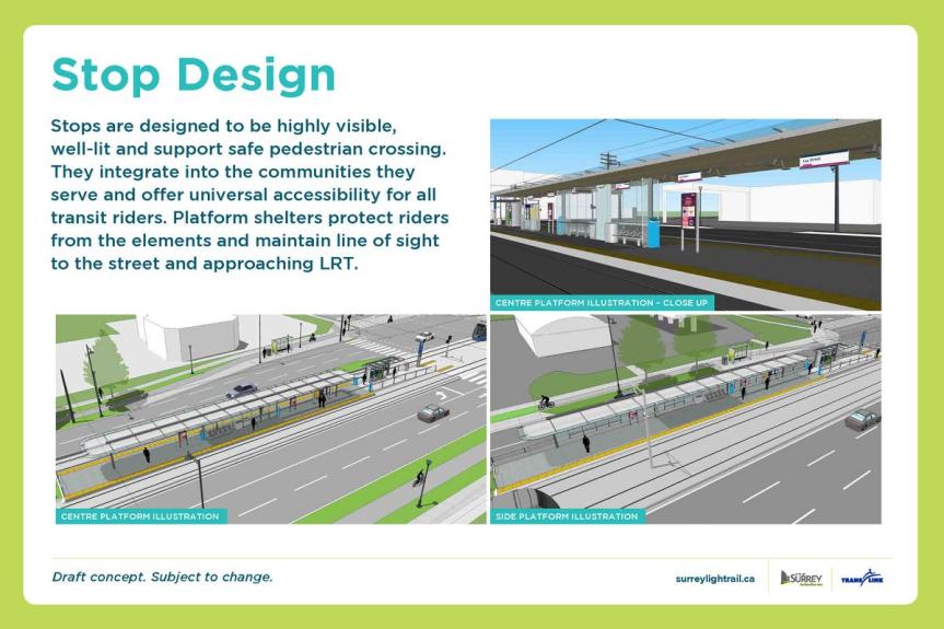
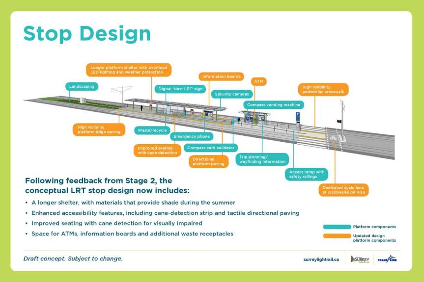
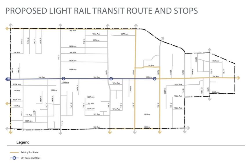
The City of Surrey began a series of 3 open houses on Thursday for Phase 1 of the upcoming Surrey LRT project. This latest public engagement is the 3rd round of open houses on Phase 1 the project, providing refined plans based on public input from previous consultations. Presented at the open house were preliminary station designs, road designs, information on construction planning, environmental and socio-economic study results, and more. A full set of the Open House Boards can be found here.
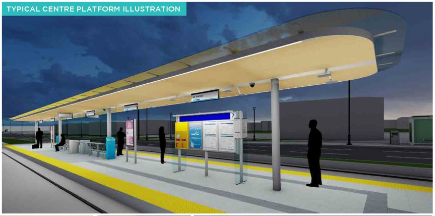
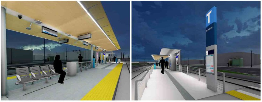
Station Designs
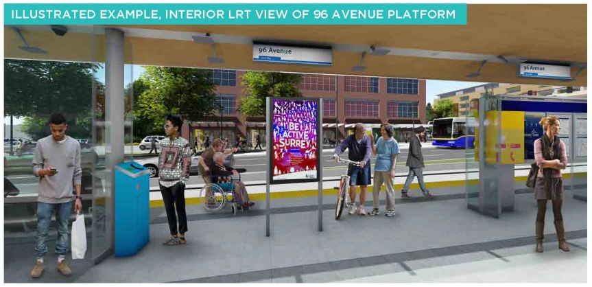
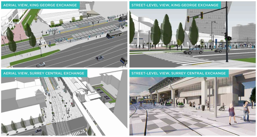
Overall, stations are designed to be highly visible, well-lit, and well integrated into the community – accessible by well-marked pedestrian crossings providing universal accessibility for all riders. Lengthy platform shelters protect riders from weather, and include space for ATM’s, information boards, seating, and more – while maintaining a clear line of sight to the street and approaching trains. Stations will in most cases be located in the centre median of the street, with the exception of King George, Surrey Central and Newton Town Centre – where they will be plaza oriented, or off to the side. Public art will also be integrated into stations along the route.
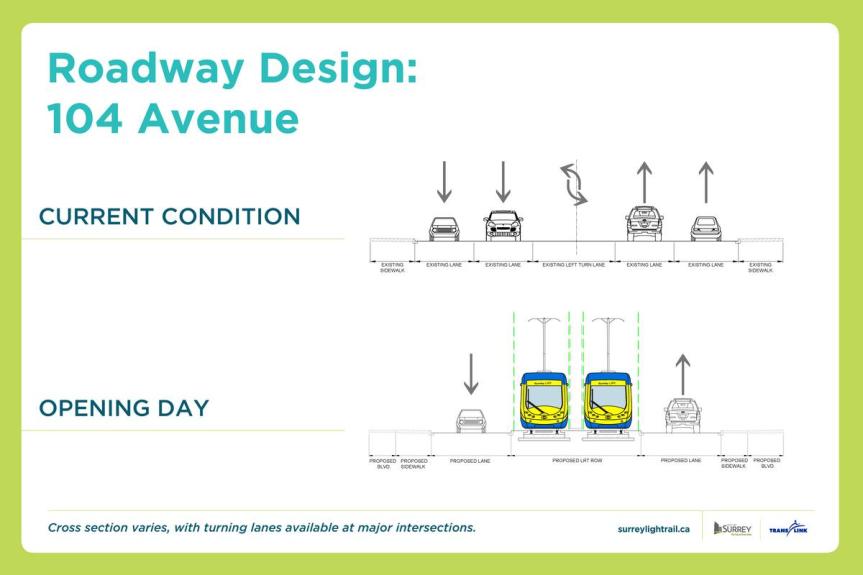
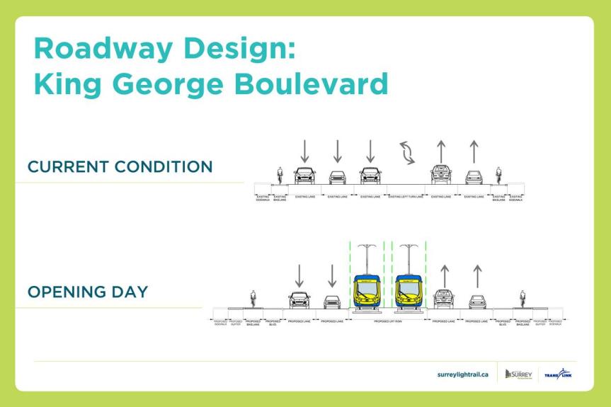
Roadway Design
LRT will run on its own dedicated track for the entirety of the line, with the exception of City Parkway where it will be integrated into a pedestrian plaza. Placement of the LRT track will vary – typically located in the centre median for most of the route, but off to the side in some sections.
Roadway design for 104 Avenue will consist of LRT in the centre median, and 1 traffic lane in each direction, widening to include an additional turning lane at major intersections. The 104 Avenue design will also provide upgraded and enhanced sidewalks, pedestrian crossings, and connections to stations. Currently 104 Avenue functions as a non-pedestrian friendly, busy arterial for cars. A re-purposed 104 Avenue with LRT will transform the street into a calmed, pedestrianized and transit-oriented corridor, supported by multi-family housing and streetfront shops along the route. The newly widened 100 Avenue and existing 108th Avenue corridors will become the new car-prioritized east-west routes between City Centre and Guildford while 104 Avenue will be the pedestrian/transit prioritized corridor.
Roadway design for King George Blvd will retain 2 traffic lanes in each direction while allowing for LRT in the median for the majority of the route. Sections of King George in City Centre will see LRT routed off to one side. New separated bike lanes, enhanced sidewalks, and pedestrian crossings will also be a key component of the re-designed King George.
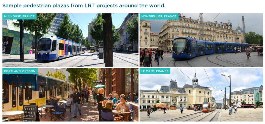
Pedestrianized Plazas at Surrey Central & King George Stations
Taking inspiration from leading cities around the world, Surrey Central and King George Stations in City Centre are designed to be integrated into new pedestrianized public plazas. These plazas will help to create vibrant transfer points between LRT and SkyTrain’s expo line, similar to plaza’s found throughout Europe with multi-modal rail connections running through them.
Socio-Economic Study: Improved Travel Times
A key finding of the socio-economic study released at the open house, was the improvement in travel times that LRT will offer over the existing 96 B-Line bus service, as well as private automobile. Under Section 7.2 of the study it was found that the existing 96 B-Line service between Guilford-Newton currently takes 29 minutes under ideal conditions. During periods of congestion however, this trip can take longer than 50 minutes. Further, this travel time is expected to worsen as population grows. LRT is able to cut this travel time by up to half, taking a consistent 27-minutes every time, on opening day, and a decade later, due to its dedicated track. In addition to this, LRT offers faster service and improved experience due to:
- More doors for boarding, significantly reducing stop times at stations, and travel times overall.
- Nearly twice as frequent peak service as the existing 96 B-Line peak bus service.
- A smoother, more comfortable ride than B-Line bus, with less stop and go.
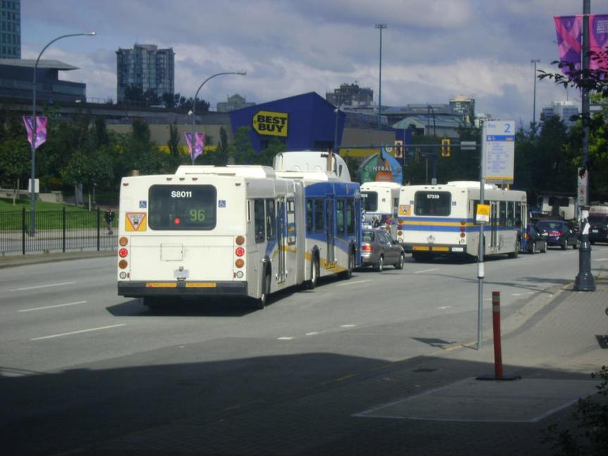 96 B-Line subject to traffic congestion – travel times between Guildford and Newton up to 50 mins during peak hours.
Integration with the Community
One of the key benefits of LRT is its integration with the community and streetscape compared to SkyTrain. While SkyTrain serves well as a long distance commuter rail service, LRT is better suited to more localized routes in the region – similar to other cities where there are various tiers of rail transit making up the regional transit network. Not every line in a city needs to be the same type of rail transit – LRT, Subway, and Commuter Rail are often combined to compliment each other and serve different needs. The introduction of LRT to Metro Vancouver represents a maturing of our rail transit network into a multi-modal system, and it is very likely we will see LRT implemented elsewhere in the region following Surrey.
In Surrey, the 104 Avenue and King George Highway corridors that make up the ‘L’ line are much better suited to urban-style LRT than SkyTrain. Not only is this route more localized than regionally serving, but SkyTrain just doesn’t make sense from a cost perspective, and the impacts that such guideways would have on the streetscapes. Looking at a comparison between SkyTrain guideways in Richmond City Centre and Coquitlam City Centre, it is clear to see how much better LRT integrates with the streetscape and community it passes through, rather than bisecting it with an obtrusive, shadowing, and noisy concrete structure. LRT can transform a streetscape into an inviting, pedestrian friendly, vibrant urban environment – whereas SkyTrain does the opposite.
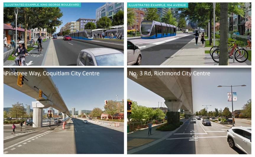 Impact of SkyTrain guideways on the urban environment/streetscape vs urban-style LRT
For more on Surrey LRT:
https://surreylightrail.ca
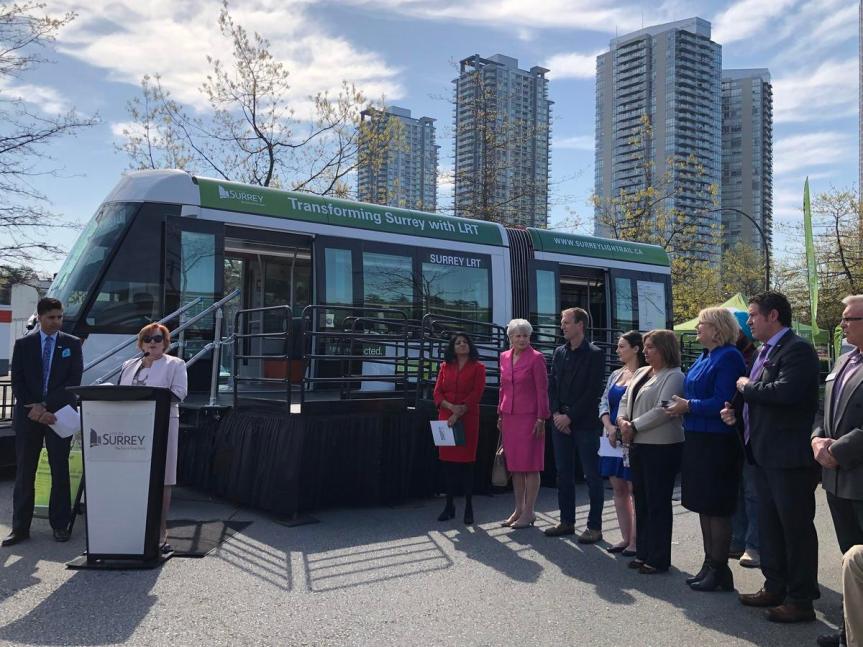
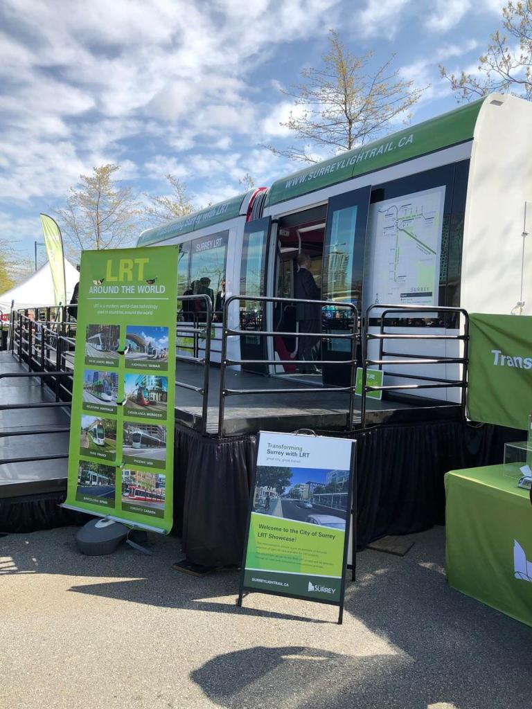
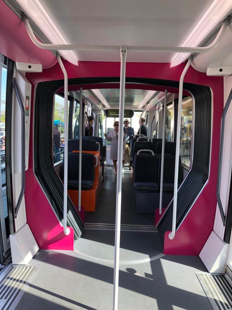
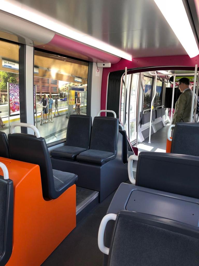
Numerous community and business leaders joined Mayor Linda Hepner today to launch an 8-week LRT showcase, offering residents a first glimpse at Surrey’s future LRT. As part of the showcase, a prototype LRT train car has been brought in from Europe and put on display in the Central City parking lot next to King George Blvd. It will remain there for the next couple of weeks before being relocated to Newton Town Centre, Guildford Town Centre, and finally the Surrey Canada Day celebration in Cloverdale.
The goal of the showcase is to give residents a first-hand look at what the urban-style LRT train will look like. Unlike high-floor commuter-type LRT trains like those in Calgary and Edmonton, Surrey’s LRT will be low-floored, similar to those found in many cities throughout Europe, and even Toronto. Despite being more integrated with the urban environment, the trains will nonetheless run on a dedicated right-of-way, apart from traffic, offering significant improvement over a bus – not only in speed, but also through more consistent/reliable schedules, frequency, capacity, boarding doors, and comfort. It is important to point out that the particular train car brought in for display is just a prototype, and the actual trains chosen for the Surrey line, will likely look a bit different.

LRT was chosen as the mode of choice for rapid transit in Surrey following years of study that began as far back as 2010. Numerous options, and combinations were looked at including LRT, SkyTrain, and Bus Rapid Transit. The results found LRT to be the most cost effective system for Surrey – with 27km of LRT track (2 lines) able to be built for the same $2.2 billion price tag as 16km of SkyTrain (1 line). Surrey gets a more extensive rail transit network, better integrated with the community, creating more pedestrian-orientated streetscapes, with LRT. Further, operating costs for LRT were found to be $6 million cheaper annually, with negligible differences in travel times.
The long-awaited first phase of Surrey’s LRT is a go-ahead, following today’s announcement of an agreement between the provincial government and the Mayor’s Council to fund the project. Billed as the largest transit and transportation investment in the history of the Metro Vancouver region, the plan will see:
- Construction of the Surrey Guildford-Newton Light Rail (LRT)
- Construction of Millennium Line Broadway Extension
- Significant upgrade of existing Expo-Millennium Lines to expand capacity to meet and improve the customer experience
- An 8% increase in bus service to address overcrowding, reduce wait times and bring bus services to communities with limited service
- Improvements to sidewalks, bikeways, multi-use pathways and roadways
According to the media release, delivery of these projects will be funded by:
- $1.6 billion in fare revenues expected from higher ridership resulting from service expansion in Phase Two, TransLink resources and efficiencies.
- A 2% increase to all transit fares over two years beginning in 2020.
- Parking lot sales tax increase of 15 cents per hour for an average $5 per hour parking.
- $5.50 increase in property taxes per average household each year or about 46 cents a month, beginning in 2019.
- About $300 to $600/unit increase to the Development Cost Charge on new residential developments depending on type of dwelling.
- Revenue from a variety of transit-related commercial opportunities.
Construction by 2019 – Phase 1 Completion by 2024
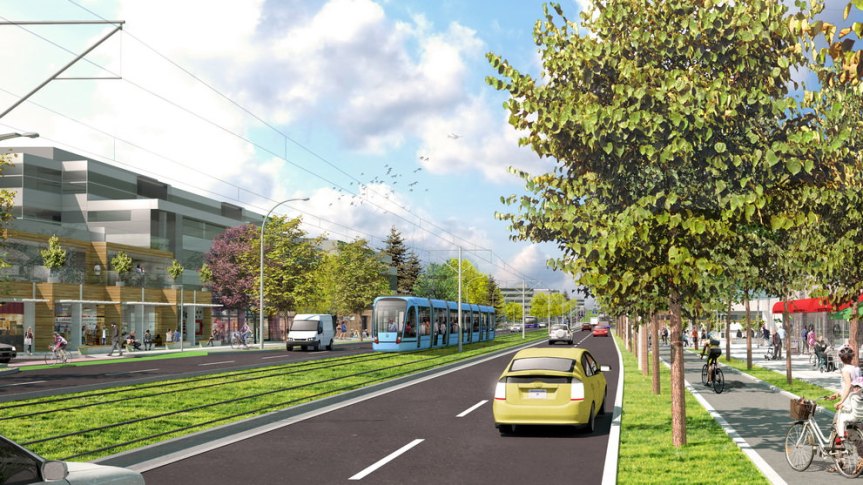
While federal matching of the provincial funding still needs to be finalized, it is expected that the first phase of the Surrey LRT line between Guildford – City Centre – Newton will likely be under construction by late 2019, with completion by 2024. Not only will the project bring a new a rapid transit line to the South Fraser, it will also be a game-changer in how it will integrate with, and transform the neighbourhoods it passes through. In conjunction with the City Centre Plan and the Guildford-104 Avenue Plan, LRT corridors will be gradually transformed with 4-6-storey density along each route, with higher density mixed-use nodes at key intersections and throughout City Centre, Guildford Town Centre, and Newton Town Centre.
 Planned route of Phase 1 & 2 of the Surrey LRT network
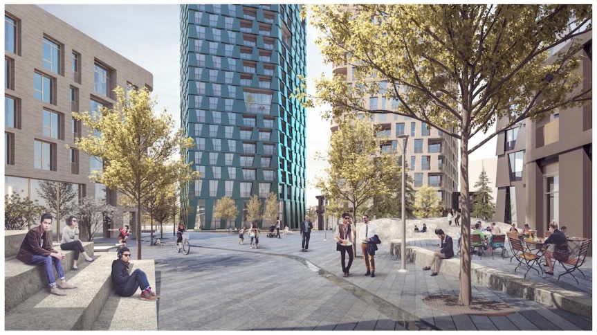
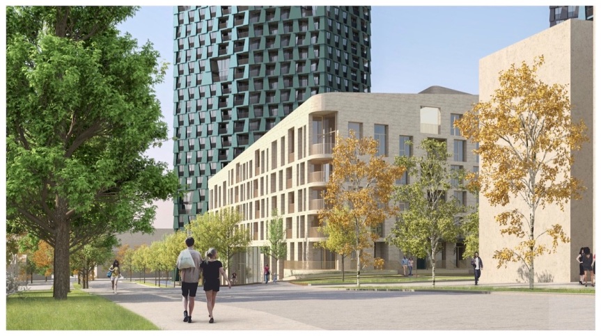
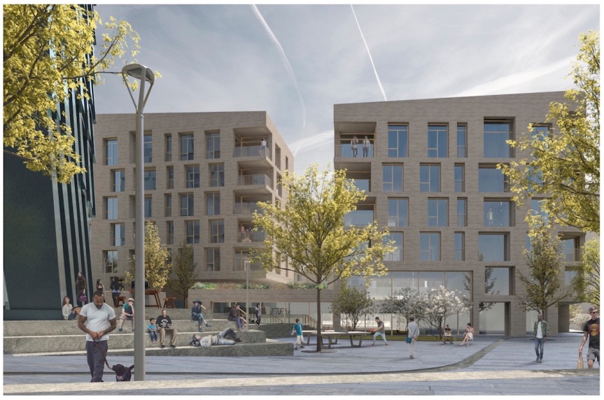
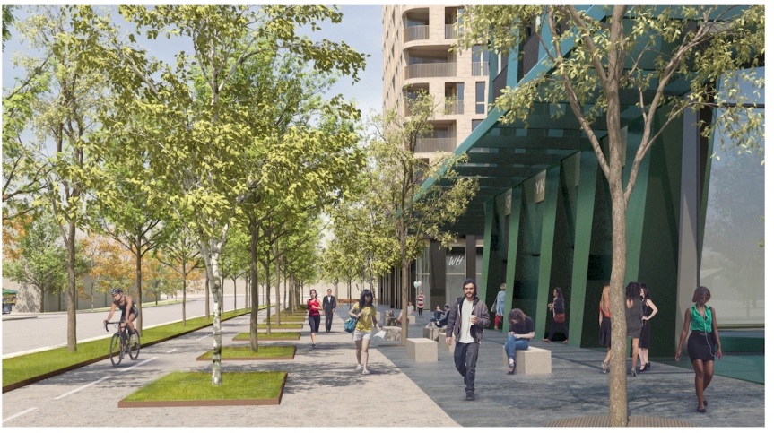
 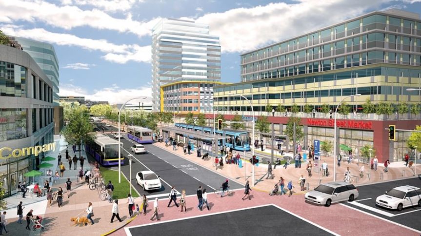 Conceptual rendering of a revitalized Newton Town Centre with LRT integration
 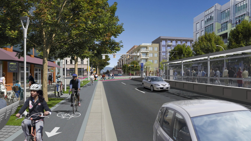 Conceptual rendering of King George Blvd in Newton with LRT, bike-lanes, and 4-6-storey urban density
 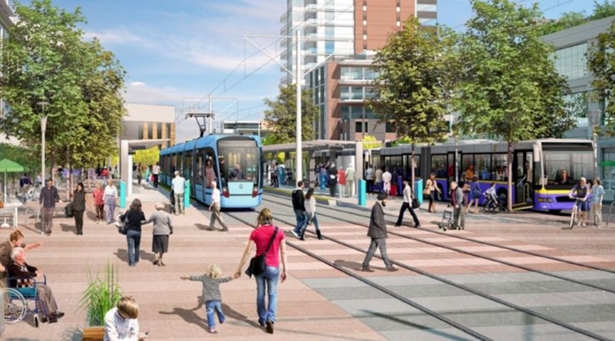 Conceptual rendering of LRT plaza integration at Newton Town Centre
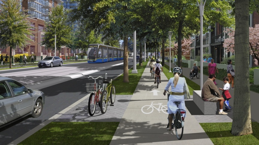
  Conceptual rendering of LRT integration along a repurposed 104 Avenue corridor
 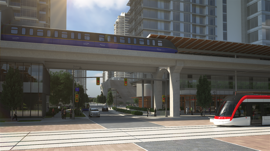 LRT integration on a pedestrianized City Parkway at Central Ave in City Centre
A new tier of rapid transit for Metro Vancouver
LRT will introduce a new layer of rapid transit service to Metro Vancouver that is complimentary to SkyTrain. It will serve as a more localized, finer-grained service, compared to SkyTrain which can be seen as more of a regional commuter train service. Tiered transit systems are common around the world, with various forms of rail combining to form an intricate and dynamic transit network. A good example of this is Berlin, Germany where there are 4 tiers of rail within its robust transit network. These include:
- Regional Train (Comparable to WestCoast Express)
- S-Bahn (Suburban service)
- U-Bahn (Urban service – Comparable to SkyTrain)
- MetroTram LRT (Fine-grained urban service)
All of these lines converge at hub stations, with each tier serving a specific purpose.
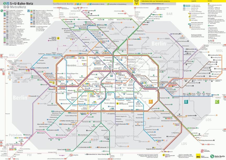 Berlin rapid transit system featuring 4 tiers of rail – LRT lines shown in light grey
Example – Tiers of Rail Transit in Berlin
 Regional Train (Comparable to West Coast Express)
  S-Bahn – Suburban service (No comparison in Metro Vancouver)
  U-Bahn – Urban service (Comparable to SkyTrain)
  MetroTram (LRT) – Fine-grained urban service
Surrey LRT will bring the first fine-grained rail service to Metro Vancouver – appropriate for routes that are more localized, and less regional – such as the Guildford-City Centre-Newton line – but connecting to SkyTrain for regional commuter travel at hub stations. It is likely that we could see LRT build elsewhere in the region following Surrey, given its cost-effectiveness and appropriate scale for many other parts of the region.

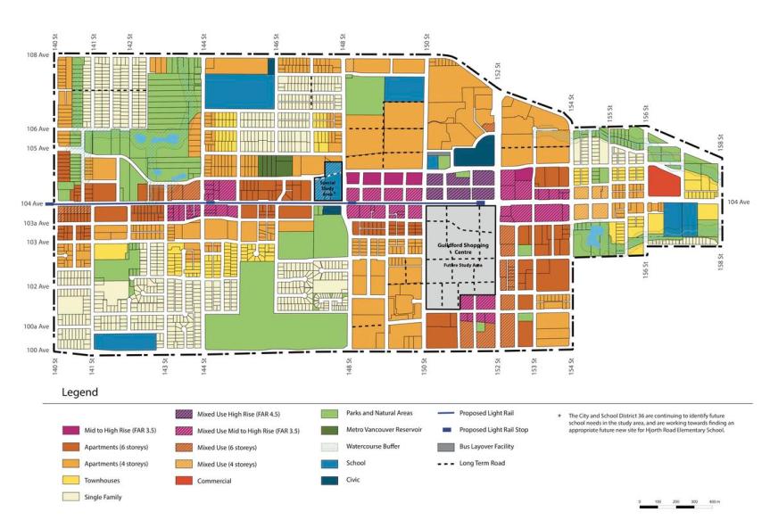 Land-Use Concept Option 1: Focused Growth
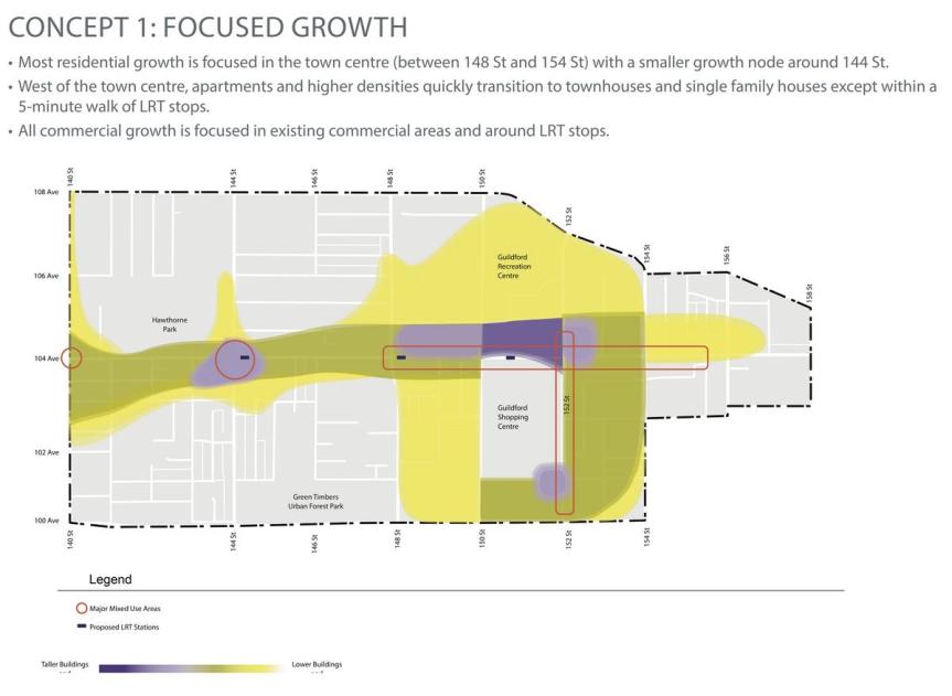
 Land-Use Concept Option 2: Dispersed Growth
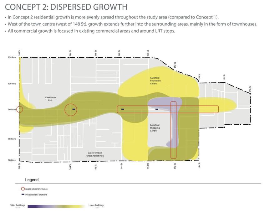
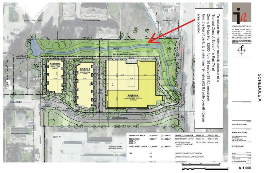 http://www.surrey.ca/bylawsandcouncillibrary/PLR_7915-0114-00(3).pdf
 One Central under excavation at Central Ave & 133A St
  Linea by Rize under construction at 104 Ave & 133 St
  King George Hub (Phase B) under construction at King George Blvd & Fraser Hwy
  Park Boulevard under construction on Whalley Blvd near 100 Ave
  King George Hub B & Park Boulevard as seen from Fraser Hwy
  Georgetown One under excavation at Whalley Blvd & 102 Ave
  City Centre 3 by Lark Group under construction on 96 Ave
  Aspire recently completed on 101 Ave near Whalley Blvd
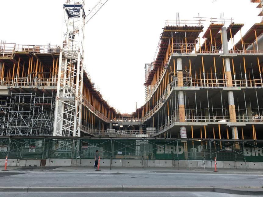
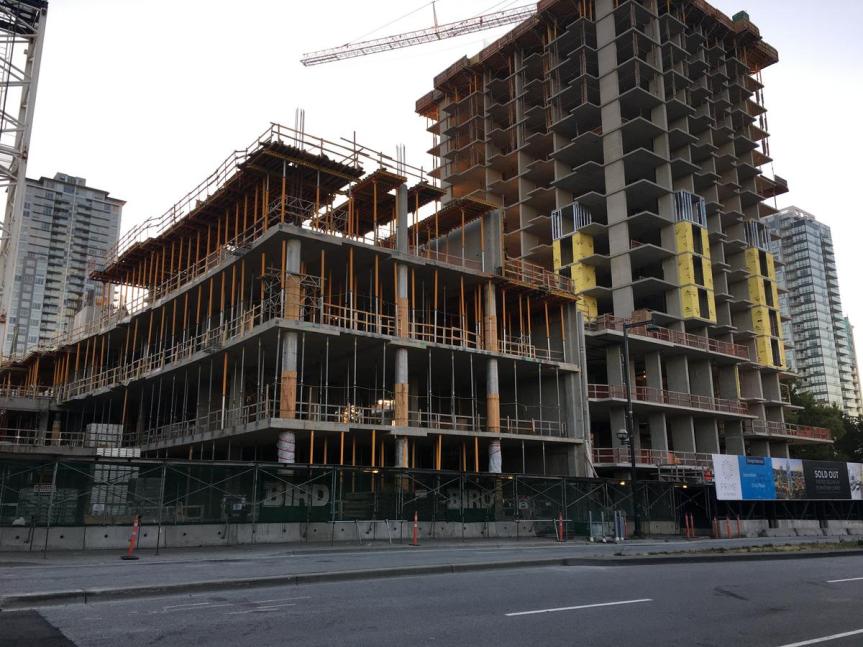
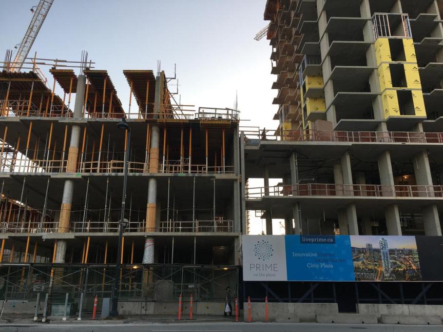
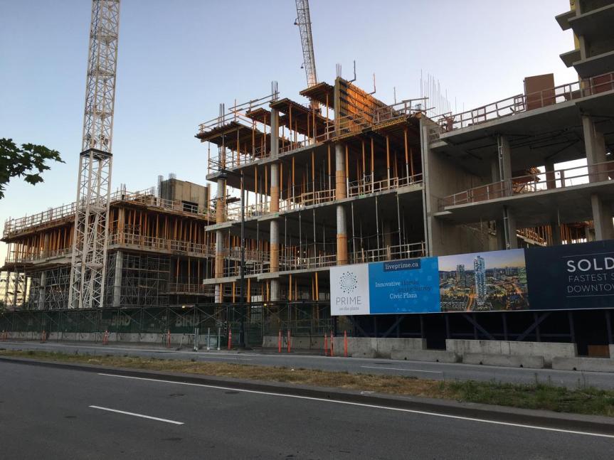
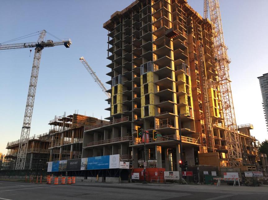
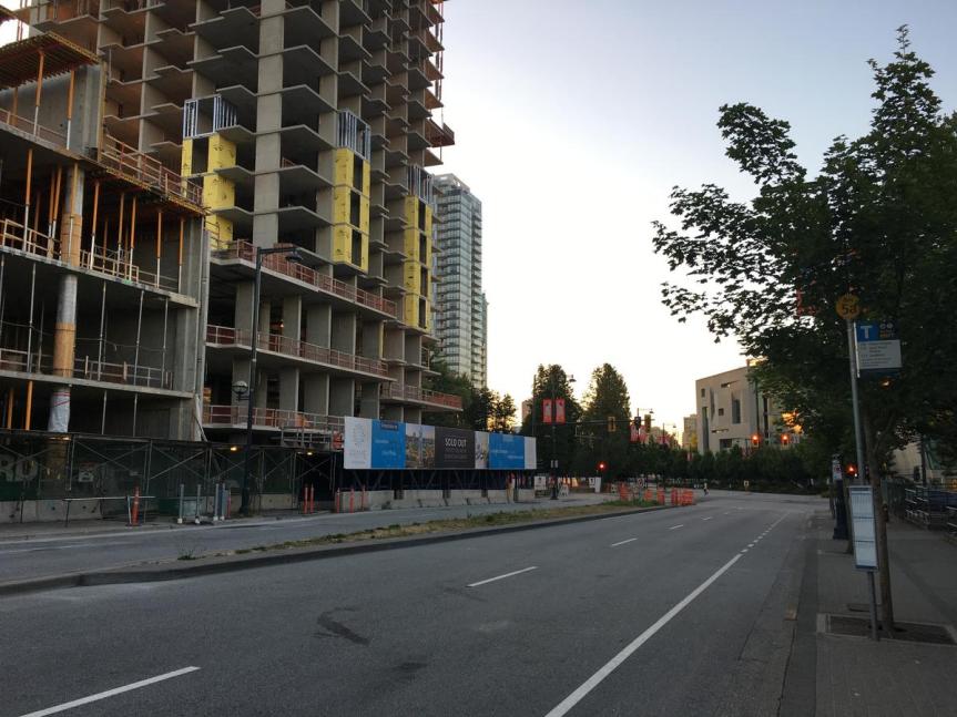
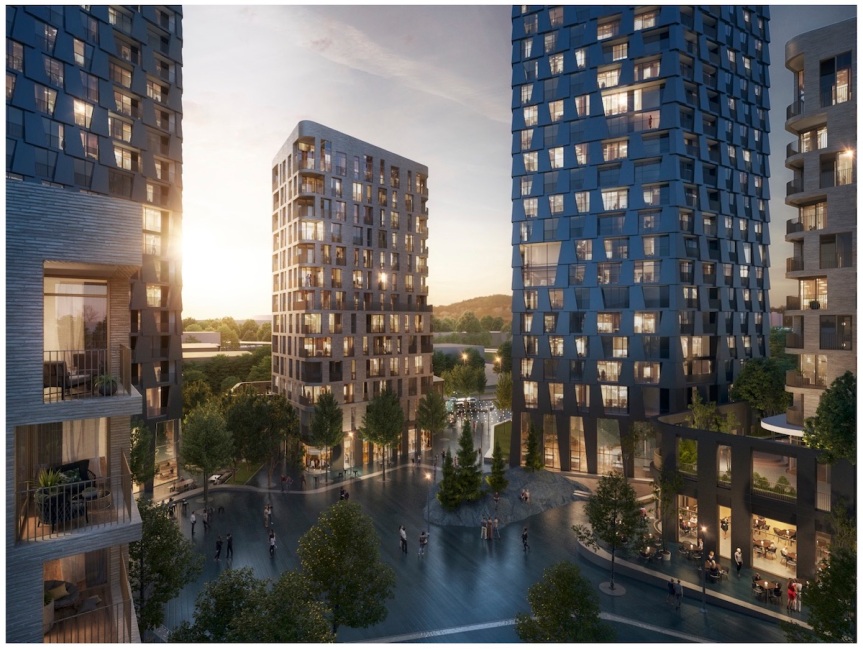
  Prime completed in Fall 2019 at University Dr & Central Ave
  HQ by Porte at 140 St & 105A Ave completed early 2019
  Evolve completed in 2019 at Central Ave & 133 St
  SFU Sustainable Energy & Environmental Engineering Building completed in Spring 2019
  West Village Park & District Energy Centre completed in Spring 2019
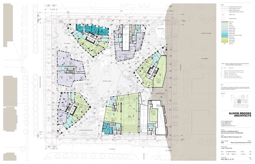
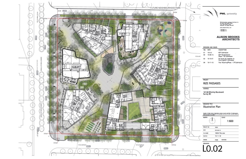
 Rendering of central public ‘Piazza’ space within Passages development
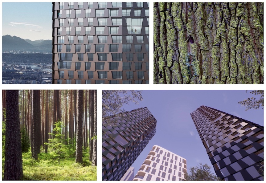

 Looking north on 137 St from City Centre 3 towards City Centre 1, 2 and future phase.
  Future Health & Technology District phase to north of City Centre 2
  Future Health & Technology District phase to north of City Centre 2
  View looking north from 96th Ave & 137th St towards City Centre 3


 Conceptual Rendering of Surrey City Centre in 2040
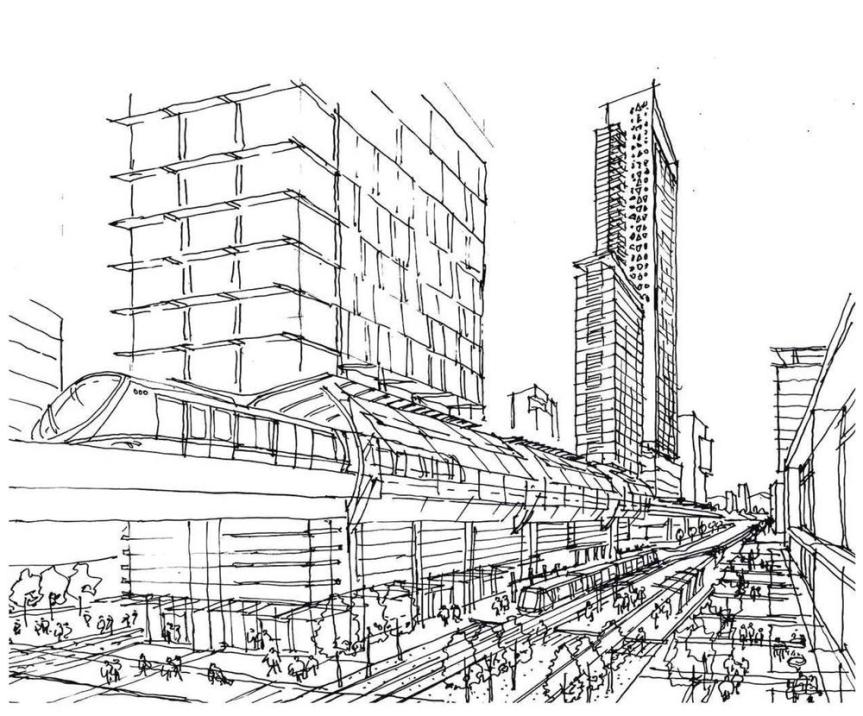


 View looking South along SkyTrain Guideway
  View Looking South-West along King George Blvd
  View looking North-West at corner of King George Blvd & Old Yale Rd
  South and East Elevations
  West and North Elevations
 Ground floor Site Plan
  Landscaped outdoor terrace on Level 3
  Landscaped outdoor terrace on Level 5
  Landscaped outdoor terrace on Level 10
  Landscaped outdoor terrace on Level 21
 New plaza at corner of Old Yale Road & City Parkway
 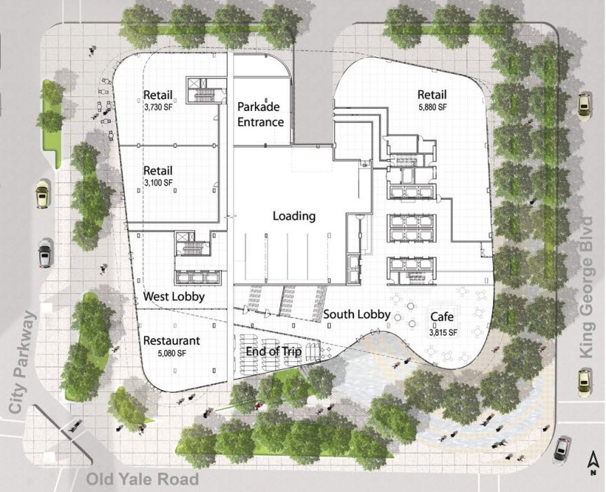 Conceptual ground level floor plan
 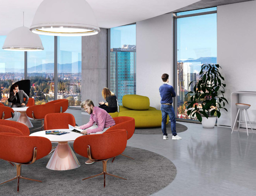 Office tower views
 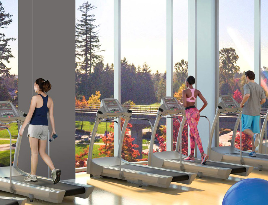 Premium fitness facilities for office tower tenants
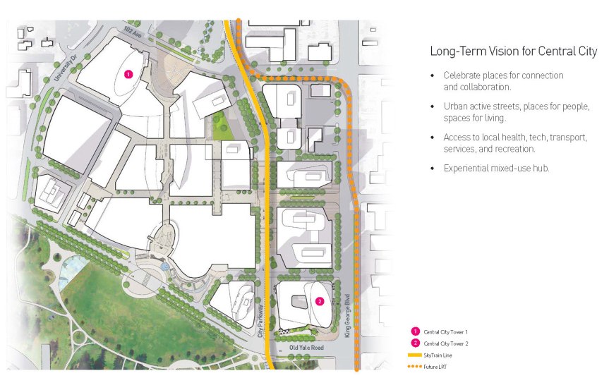

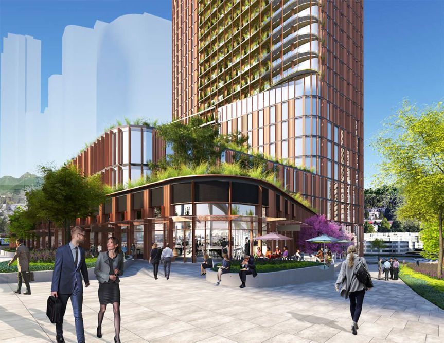
 Conceptual rendering of tower podium and restaurant at corner of City Parkway and Old Yale Rd
 Conceptualized ground-level floor plan
  Artistic rendering of views from higher-level office floors
  Artistic rendering of roof-top views overlooking Holland Park
  Artistic rendering of fitness facilities for office employees